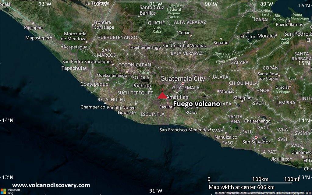
Volcanic Ash Advisory Center Washington (VAAC) issued the following report:FVXX20 at 20:27 UTC, 17/05/26 from KNESVA ADVISORYDTG: 20260517/2024ZVAAC: WASHINGTONVOLCANO: FUEGO 342090PSN: N1428 W09052AREA: GUATEMALASOURCE ELEV: 12346 FT AMSLADVISORY NR: 2026/575INFO SOURCE: GOES-19. NWP MODELS. ERUPTION DETAILS: OCNL VA EMSEST VA…
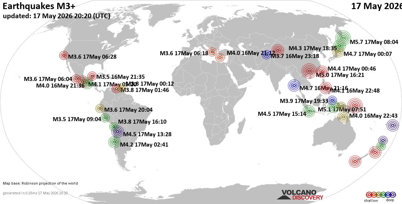
Worldwide earthquakes above magnitude 3 during the past 24 hours on 17 May 2026Summary: 3 quakes 5.0+, 31 quakes 4.0+, 155 quakes 3.0+, 308 quakes 2.0+ (497 total)This report is being updated every hour.Magnitude 5+: 3 earthquakesMagnitude 4+: 31 earthquakesMagnitude…
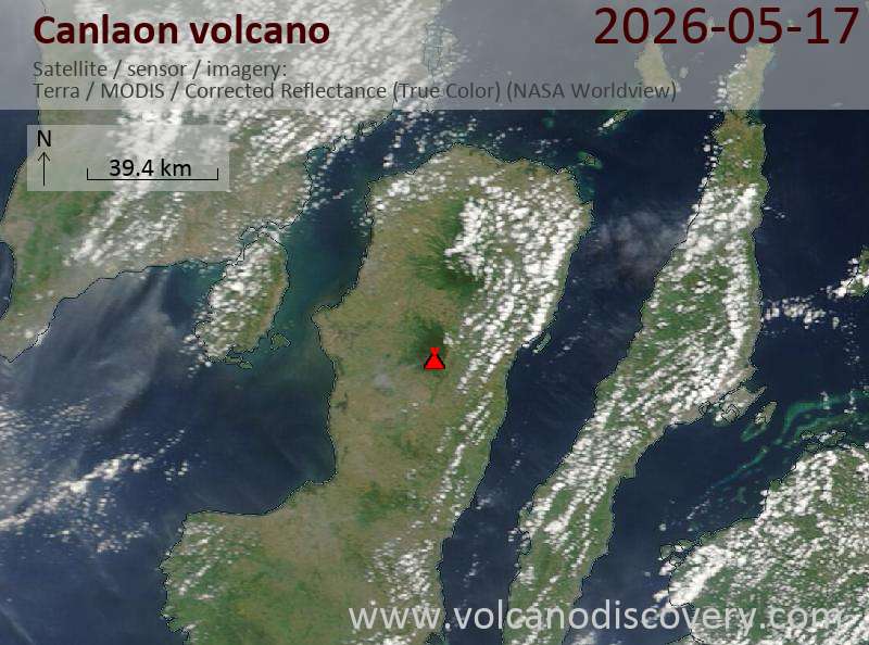
Satellite image of Canlaon volcano on 17 May 2026Volcanic Ash Advisory Center Tokyo (VAAC) issued the following report:FVFE01 at 20:05 UTC, 17/05/26 from RJTDVA ADVISORYDTG: 20260517/2005ZVAAC: TOKYOVOLCANO: KANLAON 272020PSN: N1025 E12308AREA: PHILIPPINESSOURCE ELEV: 2435M AMSLADVISORY NR: 2026/155INFO SOURCE: HIMAWARI-9 PHIVOLCSERUPTION…
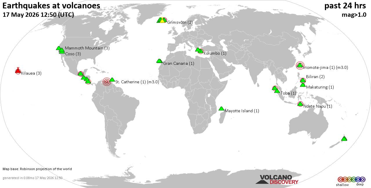
World map showing volcanoes with shallow (less than 50 km) earthquakes within 20 km radius during the past 24 hours on 17 May 2026 Number in brackets indicate nr of quakes.Quakes detected near: Apaneca Range (2 quakes between mag 1.6-1.8),…

Explosive activity continues. Volcanic Ash Advisory Center (VAAC) Tokyo warned about a volcanic ash plume that rose up to estimated 12000 ft (3700 m) altitude or flight level 120 and is moving at 15 kts in S direction.The full report…
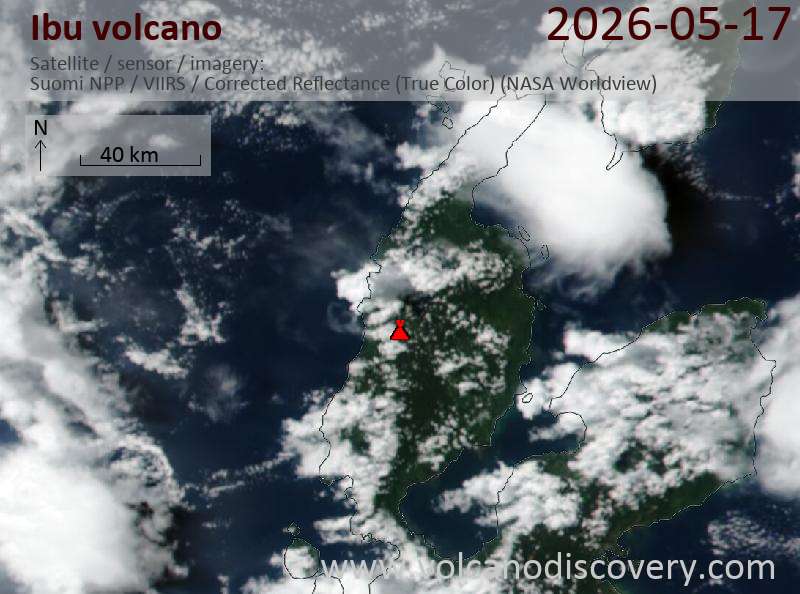
Satellite image of Ibu volcano on 17 May 2026Volcanic Ash Advisory Center Darwin (VAAC) issued the following report:FVAU01 at 18:03 UTC, 17/05/26 from ADRMVA ADVISORYDTG: 20260517/1803ZVAAC: DARWINVOLCANO: IBU 268030PSN: N0129 E12738AREA: INDONESIASOURCE ELEV: 1325M AMSLADVISORY NR: 2026/557INFO SOURCE: HIMAWARI-9, CVGHMERUPTION…
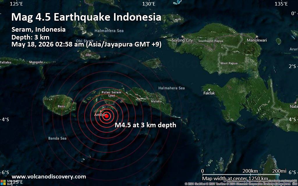
A magnitude 4.5 earthquake near Ambon, Kota Ambon, Maluku, Indonesia, was reported only 7 minutes ago by Indonesia's Meteorology, Climatology, and Geophysical Agency, considered the main national agency that monitors seismic activity in Indonesia. The earthquake occurred at a very…
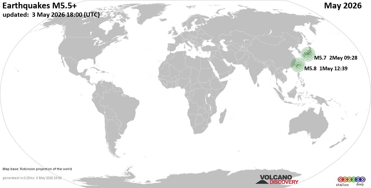
Worldwide earthquakes above magnitude 5.5 during May 2026Summary: 6 quakes 6.0+, 71 quakes 5.0+, 695 quakes 4.0+, 3254 quakes 3.0+, 6525 quakes 2.0+ (10551 total)This report is being updated every day.Magnitude 9+: noneMagnitude 8+: noneMagnitude 7+: noneMagnitude 6+: 6 earthquakesMagnitude…
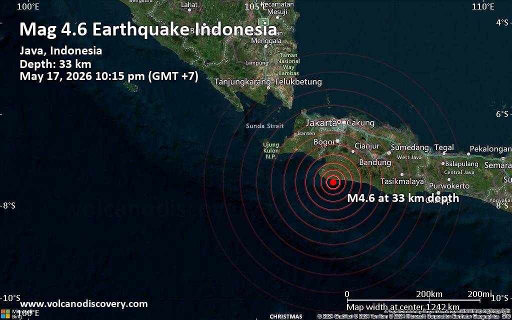
A magnitude 4.6 earthquake near Pelabuhanratu, Kabupaten Sukabumi, Jawa Barat, Indonesia, was reported only 6 minutes ago by Indonesia's Meteorology, Climatology, and Geophysical Agency, considered the main national agency that monitors seismic activity in Indonesia. The earthquake occurred at a…

Explosive activity continues. Volcanic Ash Advisory Center (VAAC) Washington warned about a volcanic ash plume that rose up to estimated 15000 ft (4600 m) altitude or flight level 150 and is moving at 10 kts in W direction.The full report…
Explosive activity continues. Volcanic Ash Advisory Center (VAAC) Washington warned about a volcanic ash plume that rose up to estimated 14000 ft (4300 m) altitude or flight level 140 and is moving at 10 kts in W direction.The full report…
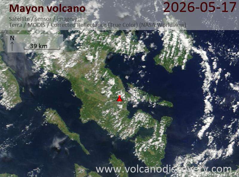
Satellite image of Mayon volcano on 17 May 2026Volcanic Ash Advisory Center Tokyo (VAAC) issued the following report:FVFE01 at 11:20 UTC, 17/05/26 from RJTDVA ADVISORYDTG: 20260517/1120ZVAAC: TOKYOVOLCANO: MAYON 273030PSN: N1315 E12341AREA: PHILIPPINESSOURCE ELEV: 2462M AMSLADVISORY NR: 2026/623INFO SOURCE: HIMAWARI-9 PHIVOLCSERUPTION…
RSS Error: A feed could not be found at `https://rss.app/feeds/2uaX4LJv39eZr1pA.xml`; the status code is `402` and content-type is `text/plain; charset=utf-8`
RSS Error: A feed could not be found at `https://rss.app/feeds/KD843mj8YEDbLDRX.xml`; the status code is `402` and content-type is `text/plain; charset=utf-8`